Dear Users! The access to the SZTFH map server (former mbfsz map server) has changed on 2024.12.02. The map server...
News
Forecasting and Assessing Europe’s Strategic Raw Materials needs (FRAME)
2021 Mar. 11.
The Mining and Geolgical Survey of Hungary is involved in the so called GEOERA which is the joint research program...
News
Mineral Intelligence for Europe (Mintell4EU)
2021 Mar. 11.
The Mining and Geolgical Survey of Hungary is involved in the so called GEOERA which is the joint research program...
News
Nowadays, mineral raw materials are an important issue
2021 Mar. 11.
The United Nations (UN) Working Group of Experts on Raw Materials has recently issued a press release drawing attention to...
News
Interactive Geothermal Information Platform
2021 Jan. 4.
Hungary’s first interactive geothermal information platform (“OGRE”) is publicly available in English.
News
ORAMA workshop at the European Comission's Common Research Center
2019 Aug. 13.
In order to secure widespread dissemination of the best practices, the European Union’s Horizon 2020 funded ORAMA (Optimising quality of...
Book page
Closed mine waste facilities
The European Commission prescribed in the ’Directive 2006/21/EC of the European Parliament and of the Council on the management of...
File
Mining concession tenders 2019 Notification
News
Report on ORAMA Symposium on the XII. “Stone-Gravel Days” Annual Mining Conference in Hungary
2019 May. 8.
On the 7 and 8 th of March 2019 was held the XII. “Stone-Gravel Days” Annual Mining Conference, where the...
Location
Rákóczibánya - Geological Core Store
Our core store in Rákóczibánya is host to hundred thousands of rocks and fossils.
Location
Mátyáshegy Gravity and Geodynamical Observatory
In the Mátyáshegy Gravity and Geodynamical Observatory long-term monitoring measurements are carried out in order to investigate Earth-physical processes related...
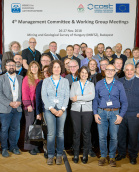
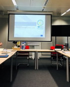
News
MINEA (Mining the European Anthroposphere) project Management Committee Meeting and Working Group Meeting in Budapest
2018 Dec. 13.
On the 26th and 27th of November the annual Management Committee Meeting and Working Group Meeting of MINEA (Mining the...
News
MBFSZ participation in the International Resource Forum for Raw Materials (FORAM)
2018 Nov. 15.
The final conference of the FORAM project aiming the establishment of the World Forum for Raw Materials was held on...
Book page
Building and construction authority
In its authority supervision, the mining authority - among others - exercises competence concerning building and construction (paragraph (3) of...
Book page
Fireworks
Information on the approval of classification codes of firework bodies prior to carriage In Annexes of agreements in connection with...
Book page
Permit for storage
The storage of explosives shall be permitted by the Mining Authority in the permitting procedure for occupancy of the explosives...
Book page
Permit for acquisition
The application for permit for performance of acquisition of explosives shall be submitted to the competent Government Office according to...
Book page
Permit for use or destruction
The application for permit for the performance of distribution of explosives shall be submitted to the competent Government Office according...
Book page
Explosives
Geothermal Energy Overview
Within the frame of the project 10 researcher of the Hungarian Geological and Geophysical Institute (MFGI) intend to participate the...
Multi-Electrode Resistivity and Induced Polarization Surveys
We recommend multi-electrode surveys for water prospecting and environmental purposes, for exploration of aggregates and for solution of geotechnical exploration...
Magnetotelluric Surveys
The MT method can be used for investigation of deep structure, water and hydrocarbon exploration. It results resistivity distribution from...
Compilation of Data Packets
Using the most complete national geological, geophysical and mining databases, the Survey compiles complex geological datasets according to the customer's...