
The gravity and the highly-accurate microgravity measurements provide information about densities and mass distributions of subsurface rocks, formations. There is a wide range in density among different rock types, consequently specialists can draw conclusions of the distribution of strata.
The gravity exploration method measures differences in the Earth’s gravitational field at given locations by accurately defining g value. By surface measurements one maps the spatial variations of the gravity field. By gravity modeling and inversion one can estimate the geological (density and rock) model which fits the best to the observed data. The gravity readings detect the integrated effect due to all masses in different depths. Further data processing (e.g. anomaly separation, filtering techniques involving mathematical operators) can be carried out to enhance information over the feature of interest (mass edge detection, structural faults, etc.). The resolution of the method is changing due to the aim of research (by choosing the station distance), from high-resolution microgravity method (1-10 m station distance) to regional studies (500 m - more km distance). The depth of penetration can be more kilometers in order.
Instrument: LaCoste&Romberg (LCR) model G gravity meters
Applicability:
– hydrocarbon and mineral exploration
– subsurface deep structure investigation
– hydrological and geothermal exploration
– geotechnical investigations
– environmental protection
– radioactive waste management
– locating caves, drifts and tunnels
– locating buried landfills
Products:
– g value (gravity of Earth) based on MGH-2013 reference level (± 0.01 and ± 0.02 mGal measurement precision)
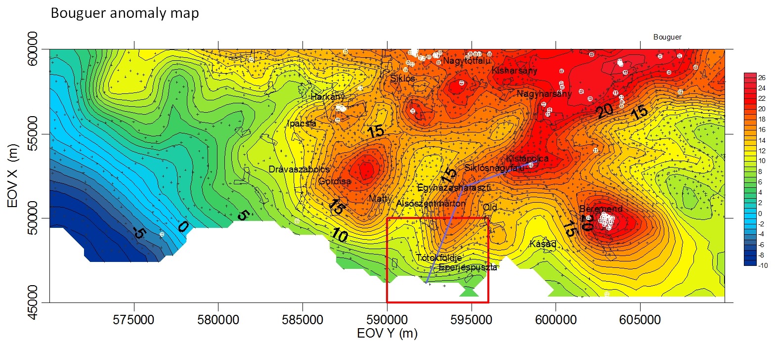
– gravity anomaly maps (e.g. Bouguer-anomaly)
– results of anomaly separation, filterings
– 2D/3D modelling
References:
– Mecsekérc Zrt.
– REAQUA Vízkezelési- és Környezetvédelmi Technológia Fejlesztő Kft.
– ENSZ CTBTO
Contact:
Department of Research and Observatories ("Mátyáshegy" Gravity and Geodynamic Observatory)
Márta KIS, Ph.D.
E-mail: kis.marta@mbfsz.gov.hu
Address: 1145 Budapest, Columbus u. 17-23.
Phone: +36 30 962-7990
